Award-winning Agentic AI specialists who are pioneering advanced, decentralized data fabric and future thinking edge compute applications in various domains, including space, aeronautics, industrial robotics, smart cities, agriculture, natural resource exploration, and many others.
Digital Infrastructure Platform:
A2DIPS is an onboard technology stack for operating systems that utilizes real-time data about the position of autonomous vehicles and robotics operating in multi-domain environments to determine safety proximity to a single Stay-In zone, and if desired, one or more Stay-Out zones.
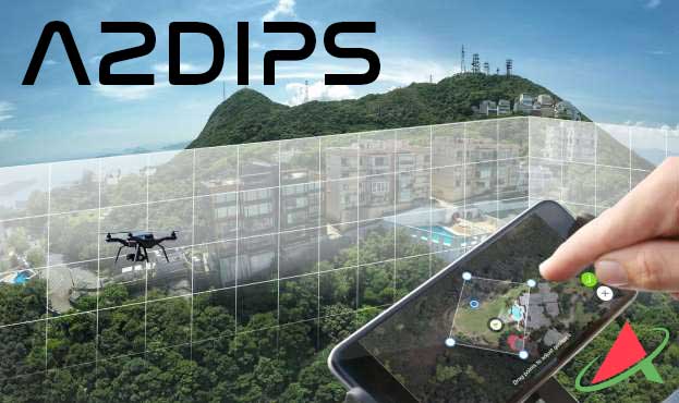
Geospatial boundaries can be derived from established “protected” zones, similar to the aeronautical charts pilots use to delineate airspace boundaries. However, A2DIPS offers a unique approach for autonomous robotics and AI-driven decision support, using geospatial data.